


Voting District 51165, Monterey County, California
About
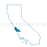
Outline

Summary
| Unique Area Identifier | 535366 |
| Name | Voting District 51165 |
| County | Monterey County |
| State | California |
| Area (square miles) | 2.35 |
| Land Area (square miles) | 2.34 |
| Water Area (square miles) | 0.00 |
| % of Land Area | 99.85 |
| % of Water Area | 0.15 |
| Latitude of the Internal Point | 36.58585450 |
| Longtitude of the Internal Point | -121.93216060 |
Maps


Graphs
Select a template below for downloading or customizing gragh for Voting District 51165, Monterey County, California


Neighbors
Neighoring Voting District (by Name) Neighboring Voting District on the Map
- Voting District 51135, Monterey County, CA
- Voting District 51145, Monterey County, CA
- Voting District 51150, Monterey County, CA
- Voting District 51160, Monterey County, CA
- Voting District 51170, Monterey County, CA
- Voting District 51175, Monterey County, CA
- Voting District 51180, Monterey County, CA
- Voting District 51195, Monterey County, CA
- Voting District 51225, Monterey County, CA
- Voting District 51240, Monterey County, CA
- Voting District 51270, Monterey County, CA
- Voting District 51300, Monterey County, CA
Top 10 Neighboring County Subdivision (by Population) Neighboring County Subdivision on the Map
- Seaside-Monterey CCD, Monterey County, CA (107,513)
- Carmel-by-the-Sea CCD, Monterey County, CA (14,704)
Top 10 Neighboring Place (by Population) Neighboring Place on the Map
Top 10 Neighboring Unified School District (by Population) Neighboring Unified School District on the Map
- Monterey Peninsula Unified School District, CA (87,070)
- Carmel Unified School District, CA (22,991)
- Pacific Grove Unified School District, CA (17,555)
Top 10 Neighboring State Legislative District Lower Chamber (by Population) Neighboring State Legislative District Lower Chamber on the Map
Top 10 Neighboring State Legislative District Upper Chamber (by Population) Neighboring State Legislative District Upper Chamber on the Map
Top 10 Neighboring 111th Congressional District (by Population) Neighboring 111th Congressional District on the Map
Top 10 Neighboring Census Tract (by Population) Neighboring Census Tract on the Map
- Census Tract 116.02, Monterey County, CA (5,266)
- Census Tract 128, Monterey County, CA (5,154)
- Census Tract 119, Monterey County, CA (4,449)
- Census Tract 132, Monterey County, CA (4,225)
- Census Tract 117, Monterey County, CA (3,810)
- Census Tract 120, Monterey County, CA (3,563)
- Census Tract 126, Monterey County, CA (2,254)